Our last destination was Morebattle which we had not visited since 2016 and this time we are going to Sedbergh in the Howgills which we also have not been to since 2016. Why this happens is kind of odd because there are places we seem to go to fairly regularly and then there are places like Morebattle and Sedburgh whicn we have not visited for years. Possibly one of the reasons is that the routes are fairly limited in some places and in others we can find a variety of routes to choose from each time we visit. Morebattle is one example as the main route into Morebattle is St Cuthbert's Way and while the scenery is really good we might get tired of doing it if we went there often.
Sedbergh is similar, we always generally come in from the direction of Kirkby Stephen which is on the A683 Road. This road goes south-east towards Sedbergh and the routes leading from it are somewhat limited for the distances we tend to do. Which is not to say they are not great routes but we might not want to do them every year like some of our other destinations.
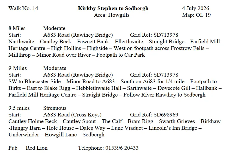
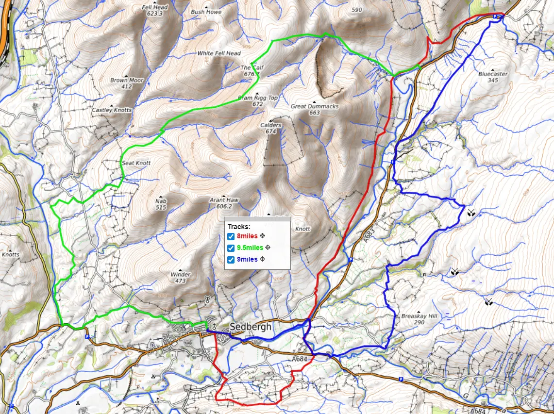
Coming south-west from Kirkby Stephen and just on the edge of the Howgills is a place called Rawthey Bridge and it is here that the 8 and 9-mile routes start. Just to the west of the A683 road is the River Rawthey and just to the west of the river is a footpath called the Pennine Journey. This is a 247 mile route starting and ending in Settle. The route goes north as far as Hadrian's Wall and the turns south.
The section the 8-mile route is walking on is one of the last stages of the Pennine Journey. Just before coming into Sedbergh the 8-mile route goes east of the river to visit the Farfield Mill Heritage Centre and then loops round to the west before coming into Sedbergh.
The 9-mile route is going on the east side of the A683 road and is walking on a combination of farmland and open moor. The moorland used to be an area where some extensive lead mining took place. This route also visits Farfield Mill Heritage Centre but then goes west to cross the river and finish the route into Sedbergh using the Pennine Journey.
Just south of Rawthey Bridge is an old pub called the Cross Keys on the A685 road and it is here that the 9.5-mile route starts. This route is going to head along the footpath leading to Cautley Spout Waterfall and from there continues climbing onto The Calf which is the highest hill in the Howgills at 676 meters. This is not a difficult climb and the views from the top are worth it. To the west is the M6 motorway and the Lake District hills beyond and to the east are the Pennine Hills with all the Howgills spread out on either side. From The Calf the route heads west to come down on a rolling hillside and then picks up the Dales Way which brings the route all the way to Sedbergh
Unlike the Lake District which will be crowded with vistors, the Howgills are one of those areas where you can walk all day without seeing another person. So if you like really great scenery with no one around except the small group you are walking with why not join us on one of these routes? You can get in touch with us from our Contact Page, you can also download the walk descriptions here and the GPS route here.
Although we visited Sedbergh in 2016 there are not many good images taken on that trip. However, the one for this post was taken in March 2014 when one of the routes climbing The Calf got caught in a blizzard while climbing to the top. Fortuately, it quickly passed over and the sun came out while making the descent.